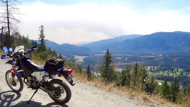
Took a ride on the DRZ today. Castlegar to Christina Lake via the Columbia and Western Rail Trail and then on to Rossland via Santa Rosa Road, Cascade FSR and Rossland-Cascade Road. About 150km of dirt.
Hot day today at 34c or about 95F.
The C and W rises slowly as it follows Arrow Lake, along trestles and numerous tunnels before turning west and arriving at Christina Lake.
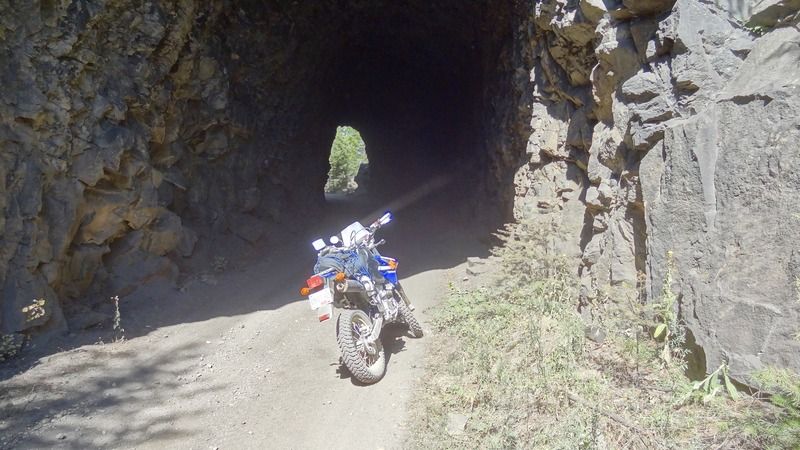
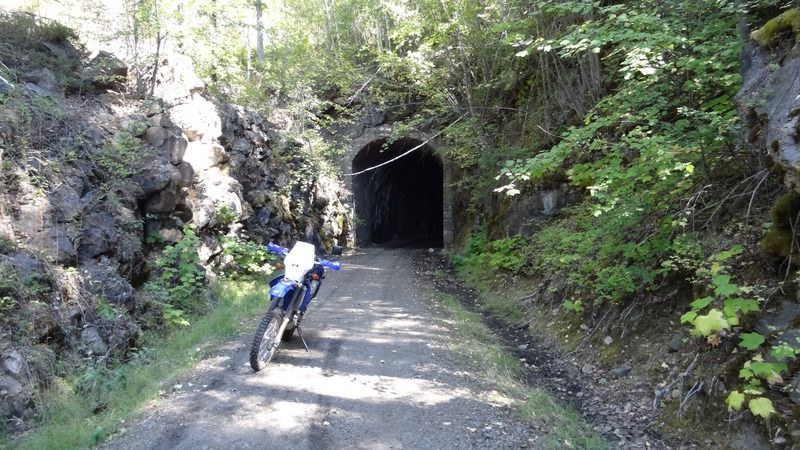
The first of several tunnels along the way.
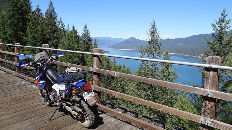
Trestles high up along the lake afford a wonderful view.
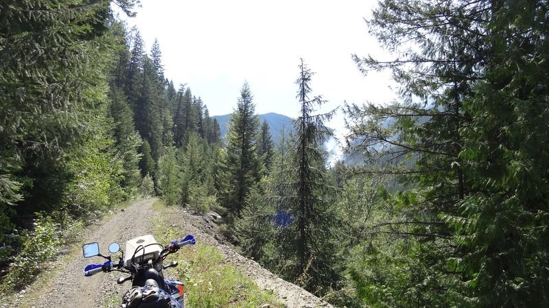
The going is quite easy but there are some amazing drop offs that inspire careful riding.
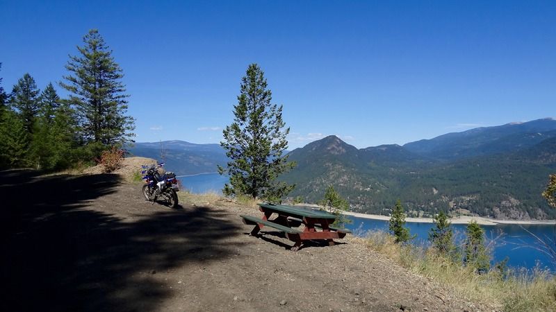
Higher up still one finds a nice picnic table and a great view of alphabetman's cabin on the other side of the lake.
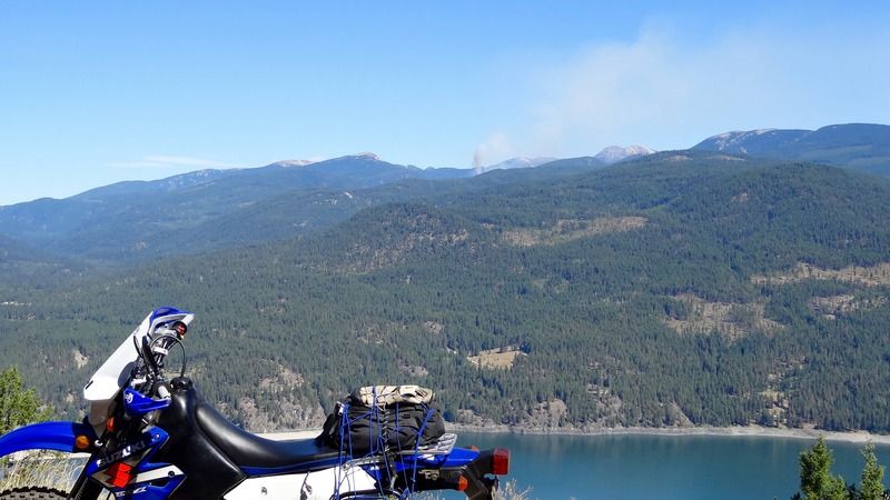
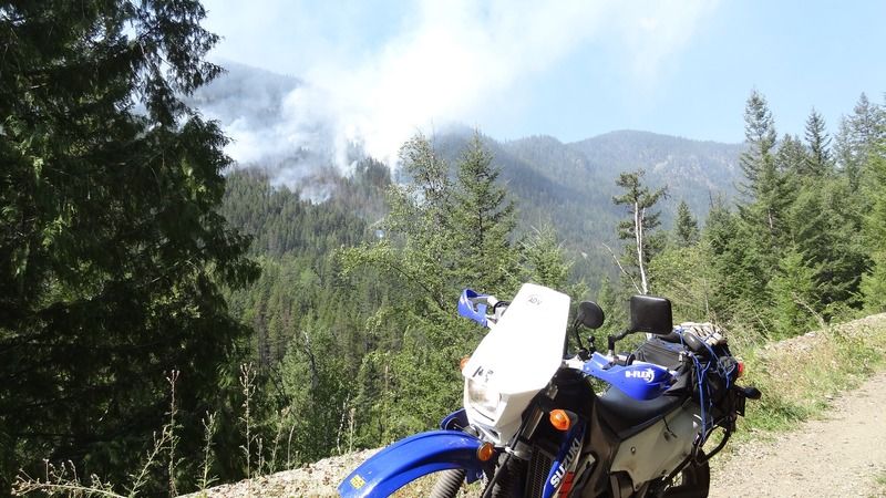
Forest fires would be a constant companion today. This one high in the mountains above Deer Park.
One of the more compelling reasons to ride the former rail bed is Bulldog Tunnel. 900 meters blasted through the mountain in Feb of 1900, the tunnel is dark, curves so you cannot see light at the end and is very cool and damp inside. I also noticed some of the support timbers had fallen to the floor. I wondered what that meant for the stability of this tunnel.
Emerging, you feel the heat of the day anew.
From here it is an easy ride down to the Paulson bridge. As I got closer smoke filled the air from the fires burning along Highway 3. Someone in Dayglo was waving at me as I rode under the bridge but I chose to ignore and kept on.
Further along the fires are visible and the Highway reduced to one lane.
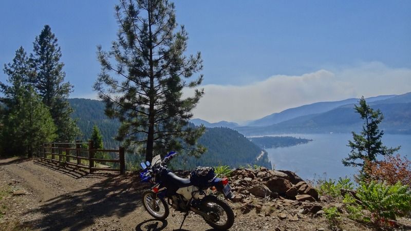
Soon the first views of Christina Lake appear with yet another fire in the distance.
Lunch in Christina at the Kool Treat and a great HotDog and Lemonade.
From there, you take Santa Rosa Road. Great views along the way, mired somewhat by the smoke.
The road climbs up and gets a bit rough in spots. Also a lot of dust as everything is so dry. The road reduced to talc in many places.
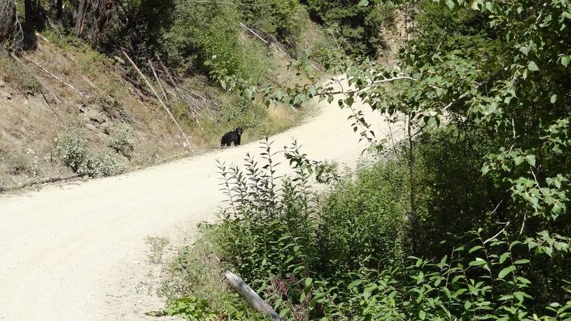
I rounded a curve and met a bear who was happy to have a staring contest. I grinned him but he couldn't see with my helmet. He casually meandered off in search ...
Soon you are at the summit of about 1800 meters and begin the big descent into Sheep Creek Valley
The talc I had been seeing started to get deeper everywhere. A fine silt that kicked up amazing dust and required standing and steering with my feet. In places it was very deep. Rounding a corner a huge, loaded logging truck could barely share the road and dusted me completely with the fine powder. Glad I had my goggles, but had to wait a while for the dust to clear. The loaded trucks were pounding the road bed into this fine silt and it become deeper as I descended.
Well over 6 inches deep, you can see the logging truck tracks for some indication
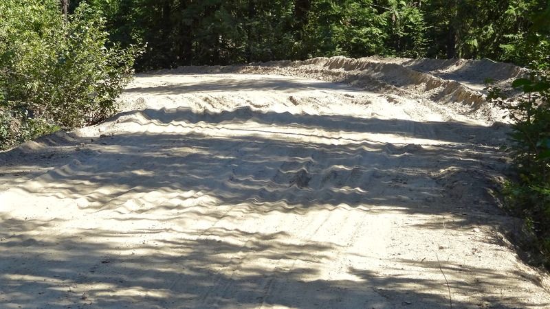
The silt was challenging but the light and nimble DRZ was up for it and I did not really come close to dropping and likely the best I have ridden in such conditions.
Got to Sheep Creek and washed the dust off my face and had a long and welcome drink. It was quite hot as I climbed back up the easy and well graded Rossland-Cascade rd to Rossland and home.
Dusty, sweaty fun. And helped make up for not being able to ride the now closed WABDR route.
I have tomorrow too, so not sure where I will ride or if I will take the Guzzi or the DRZ.

 Your Privacy Choices