...Deadman Road (Roosevelt National Forest)
...a "cross valley" road from Jelm WY to Tie Siding WY
My day's open, the bike's willing, the weather's great!
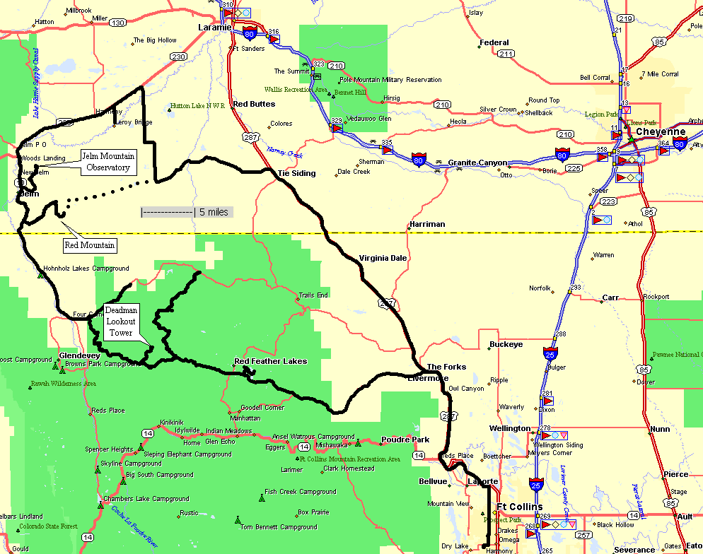
Overview map - clockwise travel
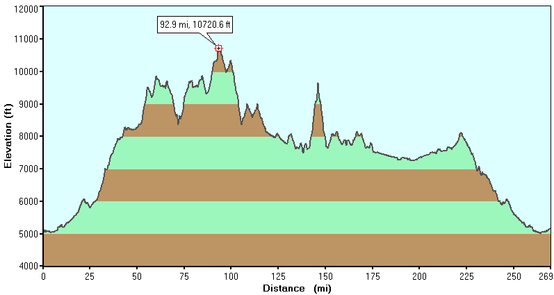
 Elevation Profile
For every 1000 feet of elevation change there's approximately 5 degrees F change in air temperature (higher=cooler).
With a high temp of 95 F at Fort Collins (5000 FT elevation) I spent the day with temps in the high 60's to the high 70's - comfortable.
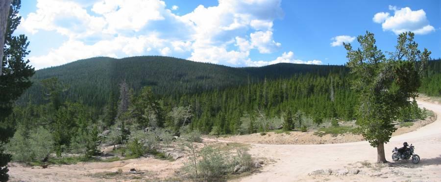
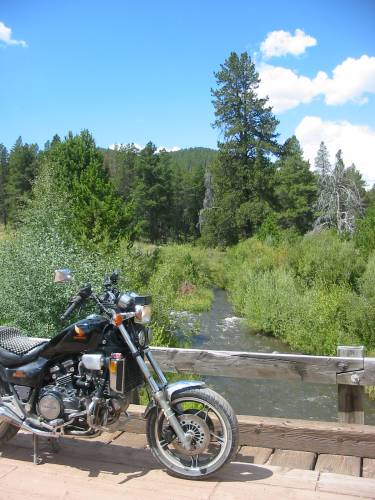
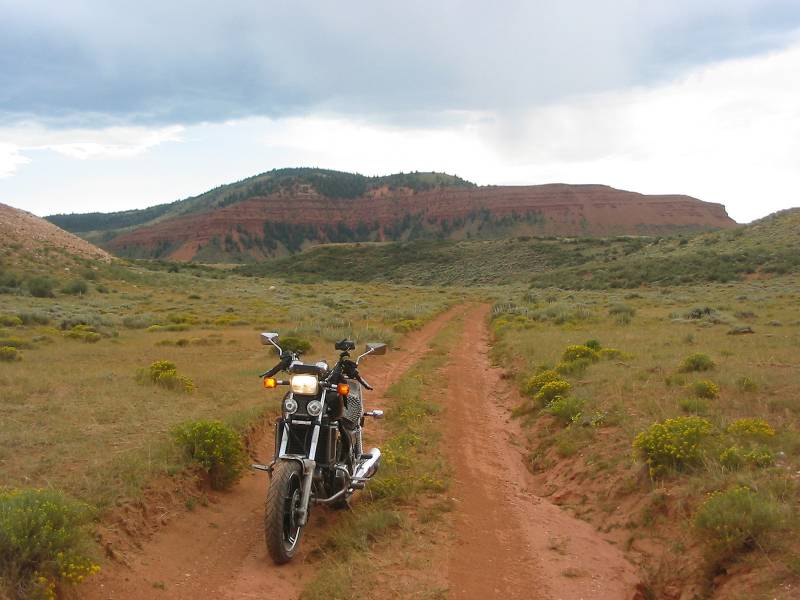
On Deadman. We've passed through the eastern gate and headed partially up the first set of switchbacks.
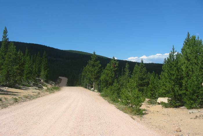
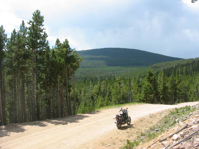
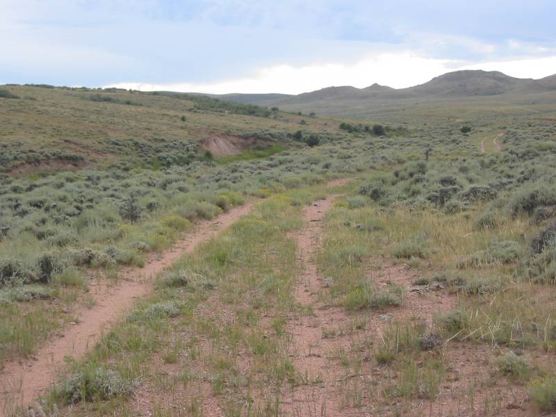
The non-asphalt roads today will be much like this.
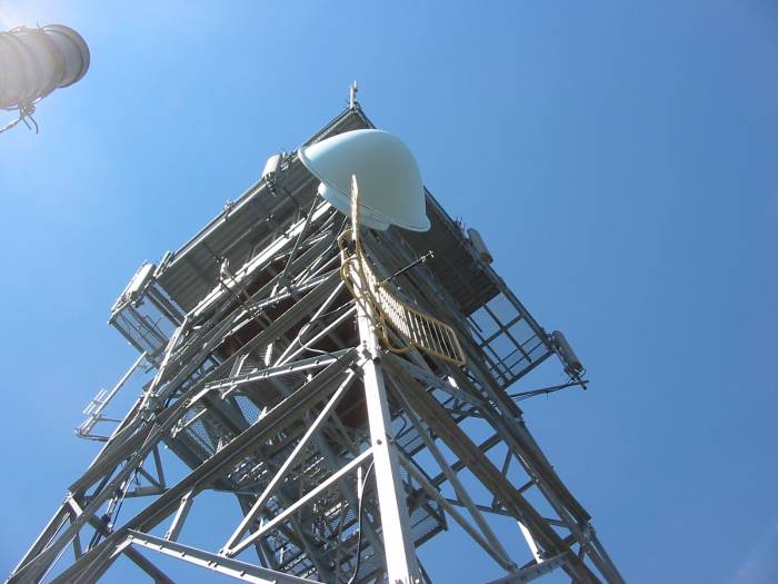
 360 Degree view from the Deadman Lookout Tower
The tower, in very good condition, is staffed by volunteers simply so that visitors like us can get access to the tower and the views it has. I spoke with Doug, the volunteer on duty, for a bit. He and his daughter came up from Boulder CO Friday evening and will stay through Sunday afternoon (the tower is open from 10a - 4p Sat & Sun in the summertime).
I'm interested enough in volunteering to call the forest service office, here in town, to know more. Imagine some shots of morning sunrises, evening sunsets, night lights on the horizon, stars. The enclosure (I didn't take any photos of it - should have - though the links above will fill you in), yes, the enclosure has a bed. A grill is located not far from the base of the tower. A vault toilet is near the parking lot. While the tower is used for antennas two nearby structures are for the electronics and power - solar power. No power exists for the tower enclosure. Verizon does get cell coverage from the antennas at the site - bonus.
A neat "find" - glad I saw the sign and took the short jump to the tower!
360 Degree Panorama(you really should click the larger size. A special note: If your web browser "shrinks" images to fit the whole image on the screen, do what you need to "expand" it to full fize. You should have to scroll right / left to view the whole image)
Click for a larger size
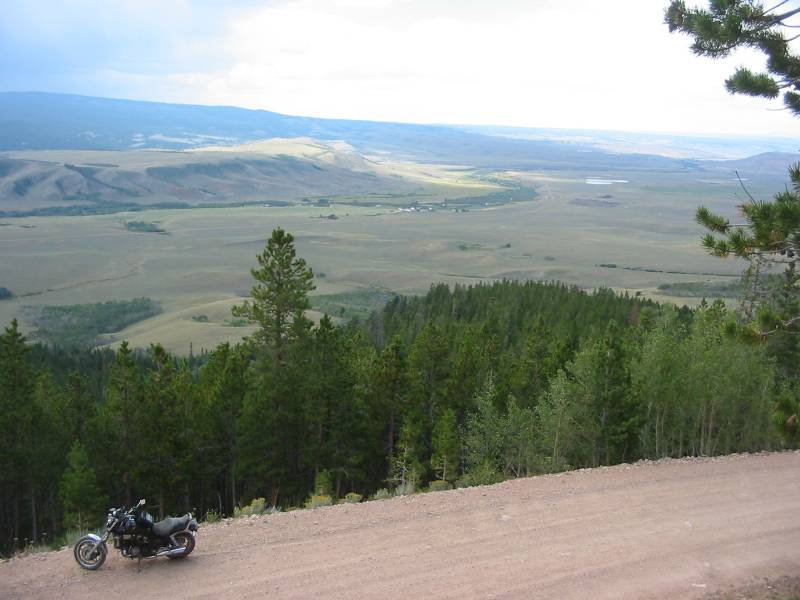
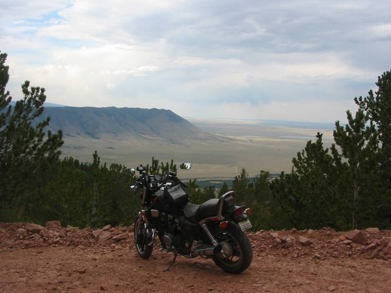
The Big Laramie River Valley. Below will be the western end of Deadman Road. The buildings in the center - near the strip of green following the river - is Four Corners, CO. Population - oh, about eight.
We've finished Deadman Road and have done another "up-n-back" to explore a few miles of the recurring route 80C (the north/south black line to the left of the "Deadman Lookout Tower" on the above map).
After the up-n-back we'llI head to Woods Landing for dinner. Their food takes FOREVER (at least the two times I've been there) but it's worth the wait, which is a good thing as they're the only game in the "town". Don't forget your piece of home made pie (thumbs up on the "Mountain Berry" though the German Chocolate tempted me).
Next door to the Woods Landing cafe / bar / dance hall / campground is the gas station / snack shop / supplies / mini-mart. After topping off with some $$$$ insurance fuel we'll check the GPS for a hopeful shortcut over to Tie Siding WY (instead of heading up to Laramie before coming down on US-287). About five miles south of Woods Landing there's a road heading east to Tie Siding - let's hope. South we head...
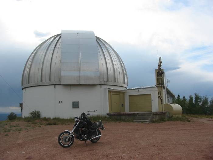
Rolling towards our "hopeful" road we come to the roadside sign for the Jelm Mountain Observatory.
A bit of information on this observatory - back on our second trip to the area (this is the third), I spotted a "shining house" atop a mountain. The setting evening sun made stand out. I even took a picture of it (but since I've yet to process those photos I can't show ya right now). So, well, windedly, when we were up with Doug at the lookout tower I saw a sign for the Jelm Mountain Observatory. That "house" I had photographed atop that mountain was the observatory. Another mental list thing - we should see if they have open to the public sessions. Now we're at the side road that'll take us up there - why not - we have enough fuel...
The road to the top was somewhat rugged - rocks mainly, though one patch of sand caught me off guard (stayed upright and moving - dirtbiking with a 500 or 600 pound bike anyone??). One benefit, for better or worse, is that the motor has good power / torque at low rpm's - came in handy on the switchback turns as I'm rolling without first gear for the rest of the season. Instead of pulling the bike apart to work on first gear I figure I can "get by" with it until winter. Two or three of these tighter switchbacks could have used first. All's good though.
Now that we made it to the top of Jelm Mountain let's take some pictures...
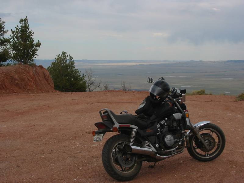
Near the top, coming down Jelm Mountain
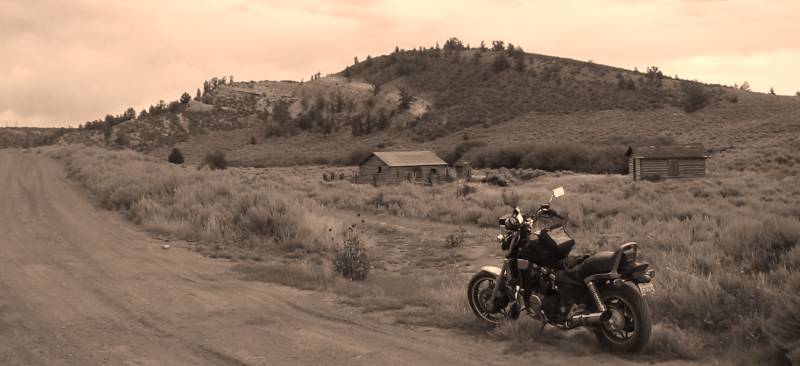
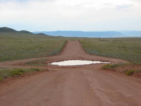
Trying to find the elusive "cross valley road"
Good fun!
The full set of photos, along with additional panoramas and information on the Deadman Tower

 Your Privacy Choices